September 16, 2022
Sea Level Rise
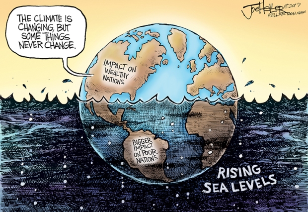
This report is an attempt to revisit sea level rise (SLR) to hopefully bring new understanding to the slow, dripping of ice that adds millimeters per year to Mean Sea Level. While the `dripping’ sounds minuscule, when you think of the size of the earth, it is enhanced by thousands of tons of calving ice (breaking of ice chunks from the edge of a glacier) each year from glaciers and ice sheets and it has thus far been translating to only millimeters of new depth to the oceans. One scary statistic is that scientists estimate that for every 2.5 centimeters (1 inch) in SLR, translates to 2.5 meters (8.5 feet) 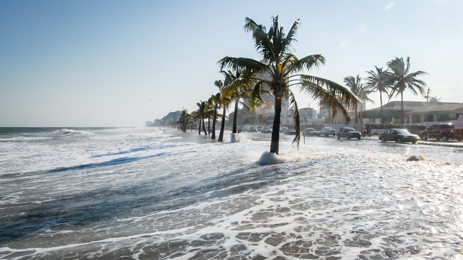 of lost beach along our coasts. Eventually it means thousands of square miles of land will be lost by rising seas. Gulf Coast and East Coast states stand to be in the forefront of lost U.S. coastlines. So far, it’s just nuisance tides during natural extra-high tides, King Tides, when the moon and sun juxtaposition alignments bring higher waters for a short time period. Even now, when high tides and extreme weather combine it’s more than a nuisance. People in such island countries like Vanuatu have already started moving from their homes to nations like Australia and New Zealand.
The Role of Technology
 New technologies in place to study this phenomena have been getting more sophisticated. Satelites are getting more in tune with SLR and can handle even minuscule rates of water filling our huge oceans. Thirty years ago, a satellite called TOPEX/Poseidon was launched in August 1992, that has been keeping track of sea level. Most scientists agree our seas have risen about 21 to 24 centimeters (about 10 inches) since 1900. The TOPEX/Poseidon has tracked a rise of 8 to 9 centimeters (about 4 inches) since 1992 (see graph). The data shows the increasing rate of water dripping from melting ice. Our leaders should be extremely concerned, as the potential to get much faster water dripping is certainly in our future.
There was a series of Jason satelites (1, 2, & 3) from 2002 through 2019 and the latest Sentinel-Six Michael Frelich satellite in 2020. This is a Joint European-U.S. (NASA) endeavor and is providing more precise, long-term, measuring of SLR. The data is showing how much faster our human-caused changes out-pace natural changes in sea level. In some cases it will confirm what we already know and provide us with more precise timing information. Other newer versions are in the process of being brought into existence, all for fine tuning these measurements. The technology is generating scientific accuracy that will be needed in the future.
Sea Ice vs. Land Ice
There are some concepts about ice melting that are poorly understood and are very important. When we talk about melting of 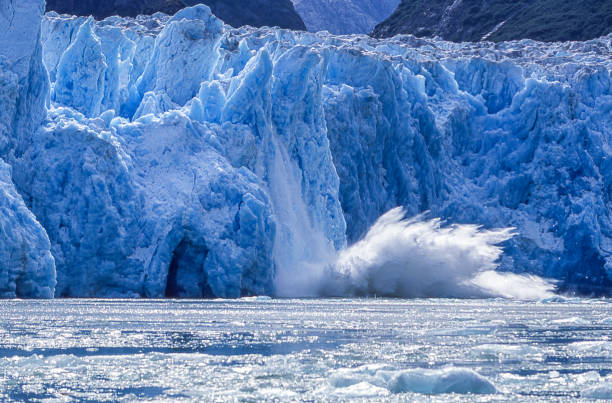
Therefore, sea level changes are due to land ice becoming “new water” in the ocean. However, thermal expansion of water when it is heated was thought to be the biggest contributor of SLR. But that has been proven false and according to NASA, thermal expansion of water contributes about one-third of the depth of oceans and ice melt is contributing most of the other two-thirds of SLR. However, computer-satellite model calculations are still working on this and as time goes on, dripping ice will likely, by far, be the biggest factor in the rise in seas than anything else.
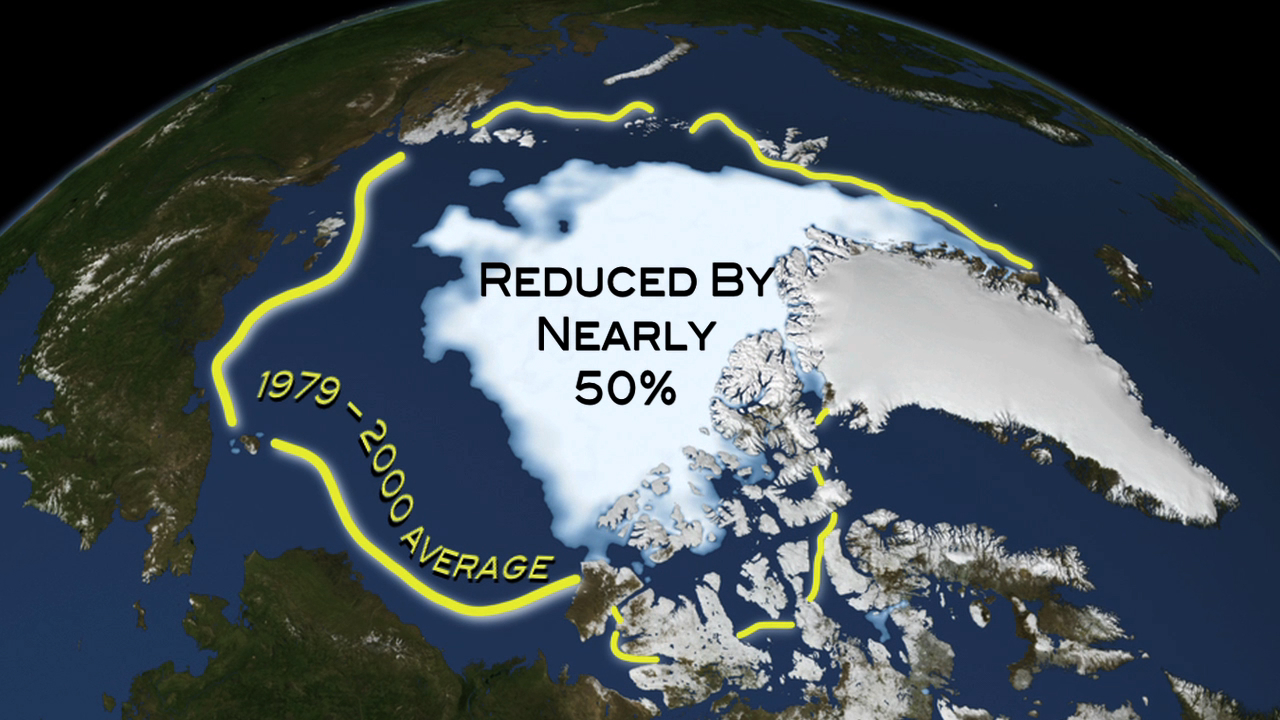
Greenland has ice averaging about one mile in thickness and Antarctica’s ice stack averages about one-and-half miles of thickness. Antarctica holds about 90% of the Earth’s ice mass and 70% of the Earth’s fresh water. If that alone melted it would increase global sea level by 190 feet. If Greenland’s ice melted it would cause a rise of about 24 feet. And if all the other mountain glaciers and ice melted along with Antarctica and Greenland, sea level could rise about 230 feet. Scientists mostly agree a rise of, at least, one meter will happen by 2100 and this may seem startlingly low. If rates of melting water increase, which seems to be the case, it could be a lot deeper, on the order of two meters is a distinct possibility. Many scientists doubt whether all of the Earth’s ice would ever melt but, if nothing is done about halting global warming, one is able to surmise that sea level could rise 100 feet by 2200. Fine-tuned data from satellites will be most important as time passes to making better predictions.
The Albedo
 There’s another concept at work here called the albedo, a natural and scientific term that defines how much light is reflected from a surface. The darker a surface is the more sunlight is absorbed, and the lighter the color more sunlight is reflected. In this case we are referring to the Earth’s Albedo. The more light reflected, the cooler the surface is and vice versa, the more sunlight that is absorbed in the surface, the warmer the surface. It’s a simple concept that has big consequences when our ice sheets melt. We rely on a certain amount of ice to maintain a livable planet and that amount is shrinking. The Albedo made for some consistency in annual fluctuations in temperature, giving us regular seasons we could depend on. That has been fairly stable until recently, but due to more and more ice sheets breaking up and melting in the seas, that is changing.
Ice sheets, glaciers and other types of congregated ice are all somewhat light in color and reflect sunlight nicely. It was keeping the earth’s surface cooler. When ice melts and becomes sea water or bare land in the case of glaciers, that space covered by ice becomes darker in color and absorbs more heat from the sun. A square mile of ice can reflect a lot of sunlight but when it turns into water (or bare land) it can no longer reflect sunlight like ice can. The more ice that melts on land or on sea, the sunlight warms the surface and that causes even more global warming. To move this a little further, the warming water under-floats ice masses and brings warmth and melting from underneath ice sheets. Therefore, you can see how allowing such a system to continue, the consequences can multiply. Things like this in nature make it difficult for scientists to measure on a global level and can cause disturbing differences of opinion on how much SLR will happen by a certain date.
Other Factors
There are more complications to this Sea Level Rise story. The Earth has been in a 20,000 year inter-glacial period, with slightly warming climate and with very slight sea level rise during that time period. We have to take that into account when we measure the dramatic increase in SLR since humanity started pumping carbon dioxide into the atmosphere. There is also land subsidence 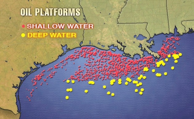 happening in various places, especially along the Gulf Coast. Oil and gas pumping along with groundwater overuse is causing areas of Texas to sink. Louisiana also has some subsidence due to oil and gas pumping along with some natural subsidence. Continental drift is causing North and South America to slowly drift further apart from Europe and Africa. The tides in the oceans aren’t the same everywhere either. Mostly there are two high tides and two low tides daily, related to the earth’s rotation around the sun, its rotation around its axis, and the moon’s rotation around the Earth. Those areas around the Gulf of Mexico, areas within Southeast Asia and elsewhere on the globe experience only one high tide and one low tide per day.
Sea level is not the same everywhere, either. Things like ocean currents can bring warm water or cold water to different regions. Warmer water adds more depth, cooler water adds less. Salinity is also another factor in all of this. The Pacific Coast of the U.S. is not affected by tides like the Atlantic Coast where water bunches up due the earth’s rotation. The spinning Earth forces water to slowly move westward until it runs into a continent like our Atlantic coast. The coastal current along the Pacific Coast is also cooler, while that current along the Atlantic Coast is much warmer. Global Mean Sea Level, or the average over a period of time, is what’s being used as a base measurement. What might be more meaningful to people on a daily scale could be something called the Local Mean Sea Level, meaning the average sea level for a certain area (i.e. San Francisco Bay).
Conclusion
To wrap this up, sea level, with all its complications and sometimes misinterpretation of the data can cause widely differing opinions and misinformation. Most of the data shows that humanity’s use of fossil fuels since about 1890 are causing a steep rise in greenhouse gases in the atmosphere, thereby causing the seas to rise at a faster rate. Even if we had everything in place to bring greenhouse gas emissions to a screeching halt, the ice would continue to melt for some indefinite time while the Earth’s climate adapts. Ice melting on a global scale is not something that changes in our open atmosphere without some sort of outside influence. It would appear that removing the heating device, greenhouse gases, as quickly as possible is our best recourse to stop the trajectory that we have set for ourselves. The United States has all the scientific wisdom needed to steer this country toward a transitional period that doesn’t cause too much havoc to our daily lives. Perhaps the coming new satellite models can bring some awareness that will offer recourse to mitigate the damage over a long period of time and help us maintain a livable planet. One thing for sure the political games being played in Congress over climate change have to stop!
Sources of Bay Area Activities and Events
Friends of the Earth – located at the David Brower Center, Berkeley.
350BayArea – Includes other 350.org branches in the Bay Area.
Planet Drum – San Francisco bio-region awareness center.
Ecology Center – Berkeley sustainability center.
David Brower Center – The environmental center in Berkeley.
Sunflower Alliance – Bay Area umbrella organization for activism.
Sierra Club San Francisco Bay – Bay Area website.
The End